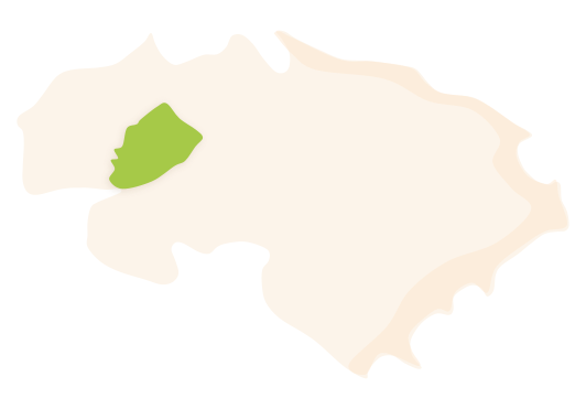
La Vall d’Ebo is located in the western interior area of the region, along the upper course of the River Girona. It is a village nestled in one of the steepest areas of the region, within one of the four valleys called Les Valls de la Marina. It is located at an altitude of 394 metres and has an extension of 32.4 km². It currently has a population of 204 inhabitants called Ebolins and Ebolines.
 La Vall d'Ebo's municipal district. Surface area: 32.4 km². Population: 204 (INE data 2021).
HISTORY
The limestone pavement in La Vall d’Ebo unfolds upon calcareous stone from the Cretaceous period. The rainwater, while seeping into the rock through fissures, has created an underground karstic landscape, which is wonderful and varied. On the surface, the main hydraulic flows are the River Ebo and the River Girona, with the ravine called Barranc de L’Infern. This hydrological wealth fills the valley with numerous springs.
To find the first signs of human settlements, one can visit one of the most important palaeolithic sites in the whole province of Alacant. The cave called Cova Fosca, considered to be the palaeolithic sanctuary, dates back to the Magdalenian period, 16,000 years ago. There, different engraved cave art panels can be seen. In the same area, further cave art was found in the cave called Cova del Reinós (15,000 BC) or the cave known as Cova de Torrudanes, with cave art from 1,800 BC, in the Levantine art style. In addition, scattered materials belonging to the Neolithic, Chalcolithic or the Bronze Age have been found there.
The origin of the current urban centre in this valley is linked to the various Andalusian farmsteads that developed there during the Muslim era. In La Vall d’Ebo, there were three farmsteads: Villars, Benissuai and Serra. Villars and Benissuai joined together to form the current centre of Ebo.
The little we know about the period after the Christian conquest is that its first lord was Bernat de Sarrià (1266-1305). The population had been eminently Muslim until the expulsion in 1609, after which the farmstead of Serra became deserted and never recovered. La Vall d’Ebo was repopulated thanks to the joint charter with La Vall de Gallinera, signed in Benialí on the 10th of June 1611 by 78 families who had come from the Balearic Islands, and especially from Majorca. They settled mainly in the two pre-existent farmsteads: Villars and Benissuai. Evidence of this fact are the surnames that are currently preserved by their descendants: Mengual, Frau, Llodrà, Muntaner, Monjo, Piera, etc. The current village began to be called Ebo at the end of the 18th century.
The village has a great agricultural tradition, which is also its main economic driving force. Historically, the use of water resources should be noted, as shown by the existing infrastructures that took advantage of the power of the river with a hydraulic mill to grind wheat or a waterwheel to irrigate the vegetable area and crops of “perelló”, a native fruit of this valley which is a mix between a pear and an apple, or other native varieties such as the Beneixama apple. There is even a festival to celebrate this fruit, the Perelló Fair, in November, coinciding with the end of the harvest.
FESTIVITIES
- The patronal festivities are celebrated in the first week of August.
- The festivities of Saint Miquel Arcàngel are celebrated in the last week of September.
- The Perelló Fair is held on the 19th and 20th of November.
GASTRONOMY
- “Putxero”: a type of stew.
- “Olleta”.
- “Minxos”: a type of cross between a corn flour flatbread and a pancake.